UAVs and Drones precision navigation in every mission

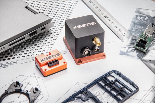
Compact Xsens inertial modules bring accurate motion, orientation and positioning to UAVs, from multi-rotors to VTOL, mapping and defense ISR platforms.

Why inertial sensors matter for UAVs


A drone must understand how it is moving - not only where it is. 

GNSS provides an external position reference, but stable flight requires continuous, high-rate information about acceleration, rotation, and orientation. An inertial sensor supplies this motion data to the flight controller or navigation system, enabling the aircraft to respond quickly to wind, turbulence, vibration, payload movement, and changes in flight dynamics. 

UAVs must also operate within strict size, weight, and power limitations. At the same time, GNSS signals may be blocked, reflected, degraded, or temporarily unavailable. The performance of the inertial sensor therefore affects more than basic flight stabilization. It influences navigation continuity, payload pointing, dead-reckoning performance, system reliability, and the amount of engineering work required to integrate and validate the aircraft. 

Reliable inertial sensing helps maintain flight stability and navigation continuity in degraded and denied-GNSS conditions.
img_1
Untitled design (6)-4

Flight stabilization and payload stabilization

High-rate attitude data for control loops.  Independent gimbal control for cameras, LiDAR or ISR payloads. 

Untitled design (7)

Navigation accuracy

Accurate position, velocity and heading estimates.

Untitled design (9)

GNSS resilience

Dead reckoning during signal blockage, jamming or dropouts.   

Untitled design (10)

Integration speed

SDKs, drivers, documentation and development kits reduce engineering effort.

IMU, AHRS and GNSS/INS for Drones and UAV Navigation 

The right navigation sensor depends on whether your application requires basic motion measurements, platform orientation, or a complete position and navigation solution.
In summary, an IMU is the best choice for raw motion sensing and custom control systems, an AHRS is ideal when accurate orientation is required, and a GNSS/INS is the preferred solution for reliable drone positioning and navigation.

Xsens Sirius IMUFinal

IMU - motion sensing and flight stabilization

An Inertial Measurement Unit outputs raw acceleration, angular velocity, and magnetic field data. It is commonly used for flight control, stabilization, embedded motion input, and systems that rely on custom sensor-fusion algorithms. Because an IMU provides relative motion measurements rather than absolute positioning, any position calculated by integrating IMU data alone will gradually drift over time.

A&M - Photo Xsens Sirius AHRS Workshop-Web

AHRS — attitude and orientation control

An Attitude and Heading Reference System provides roll, pitch, and heading information. It is best suited for attitude control, platform orientation, and payload or camera stabilization. An AHRS can continue providing orientation when GNSS is unavailable, but it is not a complete position or navigation solution.

MTi-680G smaller size

GNSS/INS — integrated positioning and navigation

A GNSS/INS combines satellite positioning with inertial measurements to provide position, velocity, and attitude. It is designed for navigation-focused applications such as route following, BVLOS operations, return-to-base functions, and dead reckoning. During a temporary GNSS outage, the system can continue estimating its position using inertial data, although position uncertainty will increase until GNSS or another external aiding source becomes available again. For applications requiring higher positioning accuracy, RTK GNSS/INS solutions can provide centimeter-level position data when suitable correction data is available.

Choosing the right Xsens sensor for your Drones/UAVs

MTi-1-series get started

Xsens MTi-8

Best when minimum size and weight are key priorities and standard GNSS-aided positioning is sufficient. Its sub-gram SMD form factor enables deep integration, while connection to an external GNSS receiver provides flexibility in the system design.


MTi 600-series 2

Xsens MTi-680

Best when centimeter-level positioning and industrial-grade inertial performance are required. It combines RTK GNSS/INS capability with a compact OEM module and external GNSS receiver support, giving developers greater control over the receiver and integration architecture.


Xsens Avior series get started

Xsens Avior Series

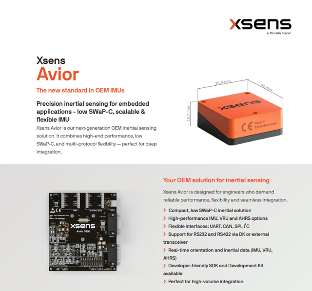
Best when the priority is high-performance orientation and inertial. A compact OEM design which delivers strong performance under vibration, dynamic motion. The broad interface support makes Avior even more suited to deeply embedded systems.


Xsens Sirius series get started

Xsens Sirius Series

Best when navigation performance and reliability in demanding environments are priorities. Its compact, ruggedized IP68 design is built to withstand severe vibration, shock, dust and water, while supporting straightforward integration into embedded systems. Available from IMU to GNSS/INS and RTK GNSS/INS configurations.


Specs comparisons picked by the numbers

Module

Xsens MTi-8
Xsens MTi-680
Xsens Avior
Xsens Sirius
Roll/Pitch accuracy
0.5° RMS
0.2° RMS
0.2° RMS
0.2° RMS
Gyro in-run bias stability
6°/h
8°/h
8°/h
7°/h
Max output frequency
Up to 1 kHz
Up to 2 kHz / 400 Hz SDI
IP rating
IP00
IP51
IP51
IP68,MIL-STD-202
Noise density
0.003 º/s/√Hz
0.007 º/s/√Hz
0.004 °/s/√Hz
0.003°/s/√Hz

Top 6 Drone Navigation Challenges — Solved by Sensor Module Performance

UAVs integration beyond airframes.

Either your airframe is a fixed wing, VTOL UAVs or Multi-rotor drone, Xsens navigation modules keep your needs as top priorities.
Explore the modules that meet your mission requirements.

High-G Launch

High-rate attitude data with a wide measurement range means no saturation during the launch spike, so you have full attitude awareness the instant the drone is airborne.

Air Turbulence

High-rate attitude data with low-latency orientation output feeds the control loop directly, holding hover accuracy and stability even in gusty air.

Aggressive Manoeuvres

Low-latency attitude tracking keeps up with fast dynamics, giving precise control through every turn with no attitude errors building up.

Temperature Swings

Individual calibration with thermal compensation across the full operating range delivers the same accuracy at -20 °C as at +50 °C, takeoff to landing.

Vibration Management & Filtering

Built-in vibration rejection and signal filtering separate true motion from motor noise, for a clean, reliable attitude estimate on any airframe.

GNSS Jamming or Denied Environments

Robust dead-reckoning keeps sensor fusion estimating position from inertial data alone, so navigation continues through GNSS outages.

From mission requirements to production readiness

1

Define your mission requirements

Identify the platform constraints and flight dynamics, GNSS availability, accuracy targets, operating environment, interface requirements, SWaP-C limitations and applicable certification needs.

2

Select the right sensor solution

Determine whether your application requires an IMU, VRU, AHRS, GNSS/INS or RTK GNSS/INS, then select the product and configuration that best match your performance and integration priorities.

3

Evaluate with a development kit

Use a development kit to explore the available outputs, configure the sensor and verify its performance against your key requirements before committing to the final design.

4

Integrate into your system

Connect the sensor to your autopilot or embedded software stack—for example, a Pixhawk-based system, ArduPilot, PX4, ROS or a custom flight controller—and configure communication, timing and data handling.

5

Validate GNSS and inertial performance

Assess cold-start behavior, convergence time, heading stability, vibration sensitivity, antenna placement and time synchronization in representative operating conditions.

6

Test degraded and denied-GNSS conditions

Evaluate dead-reckoning performance by simulating or conducting controlled GNSS interruptions, and verify how the complete navigation system behaves during signal degradation and recovery.

7

Prepare for production

Freeze the validated firmware and sensor configuration, document the integration, define repeatable acceptance tests and align technical and procurement documentation for production.

Xsens MTIs with ArduPilot and PX4: faster time to flight

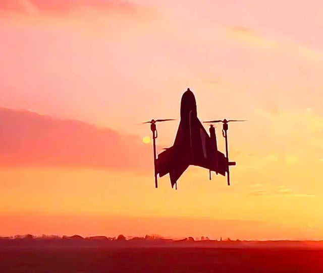
ArduPilot and PX4 are the two dominant open-source autopilot stacks in professional and defence UAV development. Between them, they run on the majority of non-proprietary fixed-wing, multi-rotor, and VTOL platforms worldwide. Their widespread use is not accidental: both provide production-ready flight control algorithms, comprehensive mission planning, and an ecosystem of compatible hardware that allows teams to go from component selection to first flight in days rather than months.  

Xsens MTI sensors are compatible with both.

Explore development kits →
vertical_takeoff_drone2

Everything engineers need to evaluate

Why Xsens

25 Years of Motion Expertise

Experience in human and machine motion tracking.

Accuracy You Can Rely On

All sensors are individually calibrated, sensor fusion optimized for real-world conditions.

Developer-Friendly

ROS drivers, Pixhawk and Ardupilot integration.

Global Support

FAEs with direct UAVs expertise in Europe, USA and Asia.

Inertial Sensors for Drones/UAVs - FAQs

What is UAV inertial navigation?

Why does a drone need an inertial sensor if it already has GNSS?

What is the difference between an IMU, an AHRS, and a GNSS/INS?

Can a drone fly without GNSS?

How does a GNSS/INS behave during a GNSS outage?

How do I choose the right inertial sensor for my UAV?

When should a UAV use an RTK GNSS/INS?

How do vibration and payload movement affect UAV navigation?

Can Xsens sensors integrate with Pixhawk, ArduPilot, PX4, and ROS?

What is a drone development kit, and when should it be used?