Enabling Dead Reckoning, mission planning, and clearer ROV operations below the surface
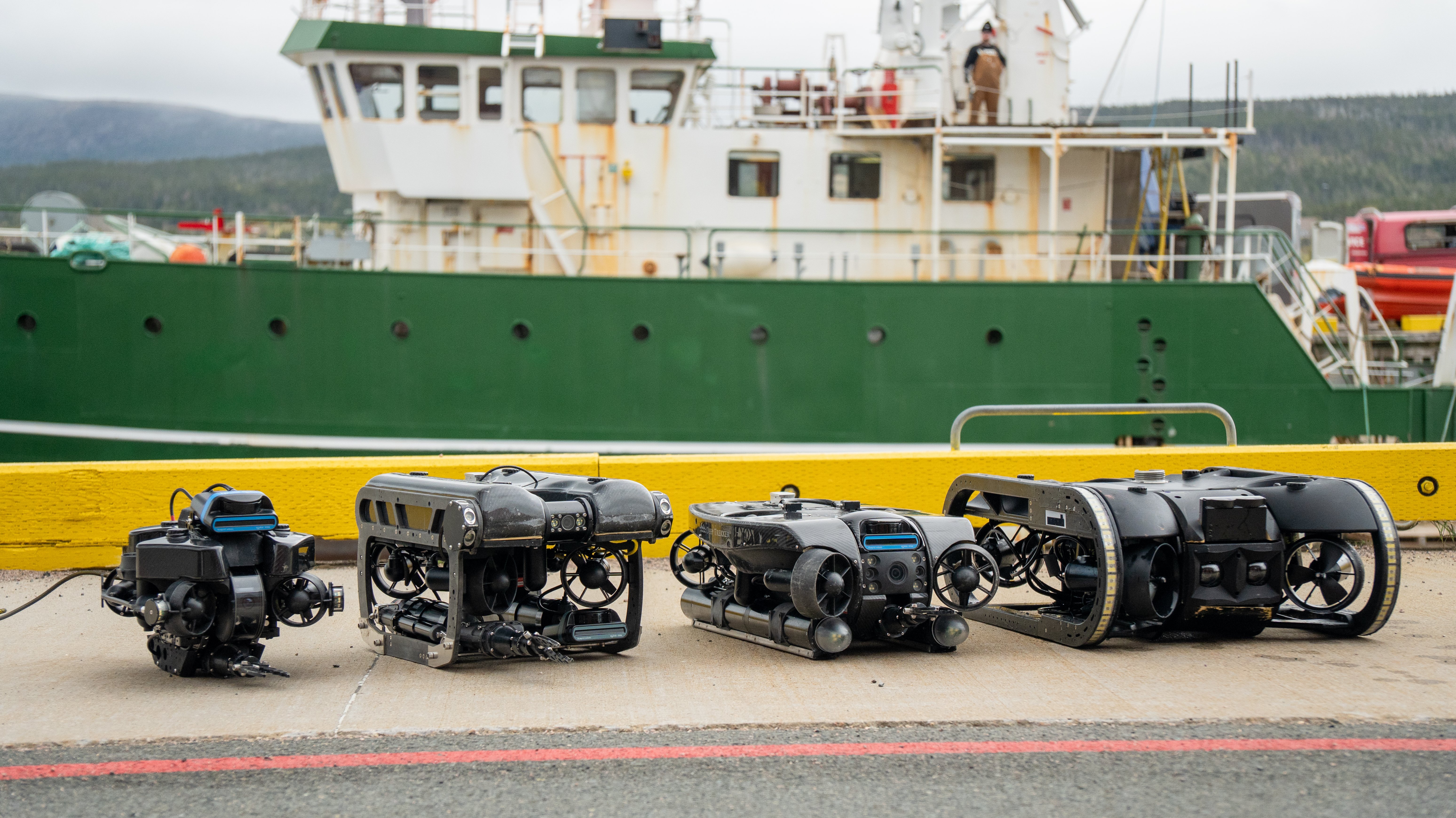
Deep Trekker designs and manufactures portable underwater ROVs used across offshore energy, civil infrastructure, aquaculture, defense, Search & Recovery, and other demanding markets. Its vehicles help operators inspect underwater assets, collect real-time data, and make informed decisions in environments where visibility is limited, conditions are unpredictable, and GPS is unavailable.
To improve underwater navigation, Deep Trekker integrated Xsens MTi-3 AHRS technology into its SensorPod+ navigation system. Together with Deep Trekker’s DVL and BRIDGE software environment, SensorPod+ supports Dead Reckoning workflows that help operators understand where the ROV is, where it has already been, and how to navigate more effectively during complex underwater missions. Deep Trekker also uses Xsens Avior in its ROVs, adding a high-performance inertial sensing option for demanding magnetic environments without disclosing product-level implementation details.
Case Overview
Customer: Deep Trekker
Application: Portable underwater ROV navigation
System: SensorPod+ with Xsens MTi-3, Xsens Avior, DVL, and BRIDGE software
Technology: IMU, AHRS, and inertial navigation for underwater Dead Reckoning
Challenge: Reliable position awareness without GPS, with magnetic interference near underwater structures
Why Xsens: Compact form factor, motion performance, price-performance balance, SDK support, and integration fit
Impact: Dead Reckoning workflows including breadcrumb trails, waypoints, route planning, and survey repeatability
The challenge: underwater navigation without GPS
Underwater navigation is technically demanding. GPS signals do not work below the surface, visibility can be poor, and external positioning references are not always practical or reliable in the environments where ROVs are deployed.
For Deep Trekker customers, this creates clear operational challenges. Search & Recovery teams need to understand which areas have already been covered. Survey operators need to follow consistent transects to collect high-quality data. Inspection teams increasingly need accurate motion and localization data to support photogrammetry, SLAM-style mapping, digital twins, and asset condition assessment.
The navigation problem becomes more complex near ship hulls, tanks, subsea structures, and other ferrous environments where magnetic interference can affect heading reliability. Deep Trekker needed a compact inertial sensing solution that could support Dead Reckoning inside a portable ROV platform without compromising ruggedness, system size, or ease of deployment.
The solution: SensorPod+ with Xsens MTi-3 AHRS and inertial sensing
Deep Trekker’s SensorPod+ adds advanced navigation capabilities to its ROV platforms. Integrated with a DVL and Deep Trekker’s BRIDGE software environment, the system helps operators plan missions, follow routes, mark points of interest, and understand the ROV’s movement underwater.
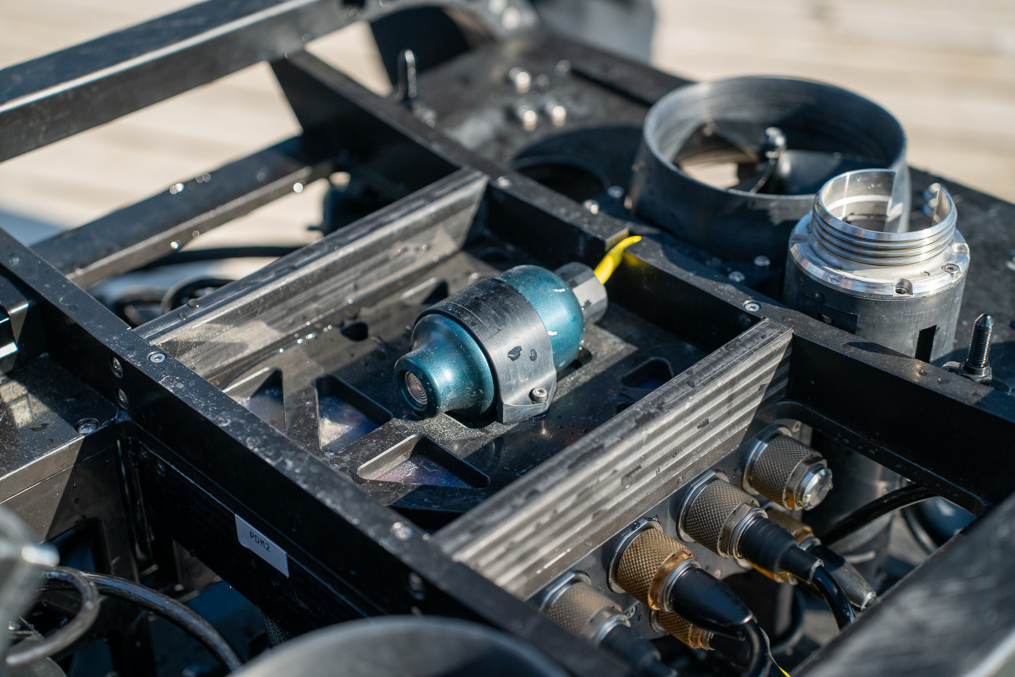
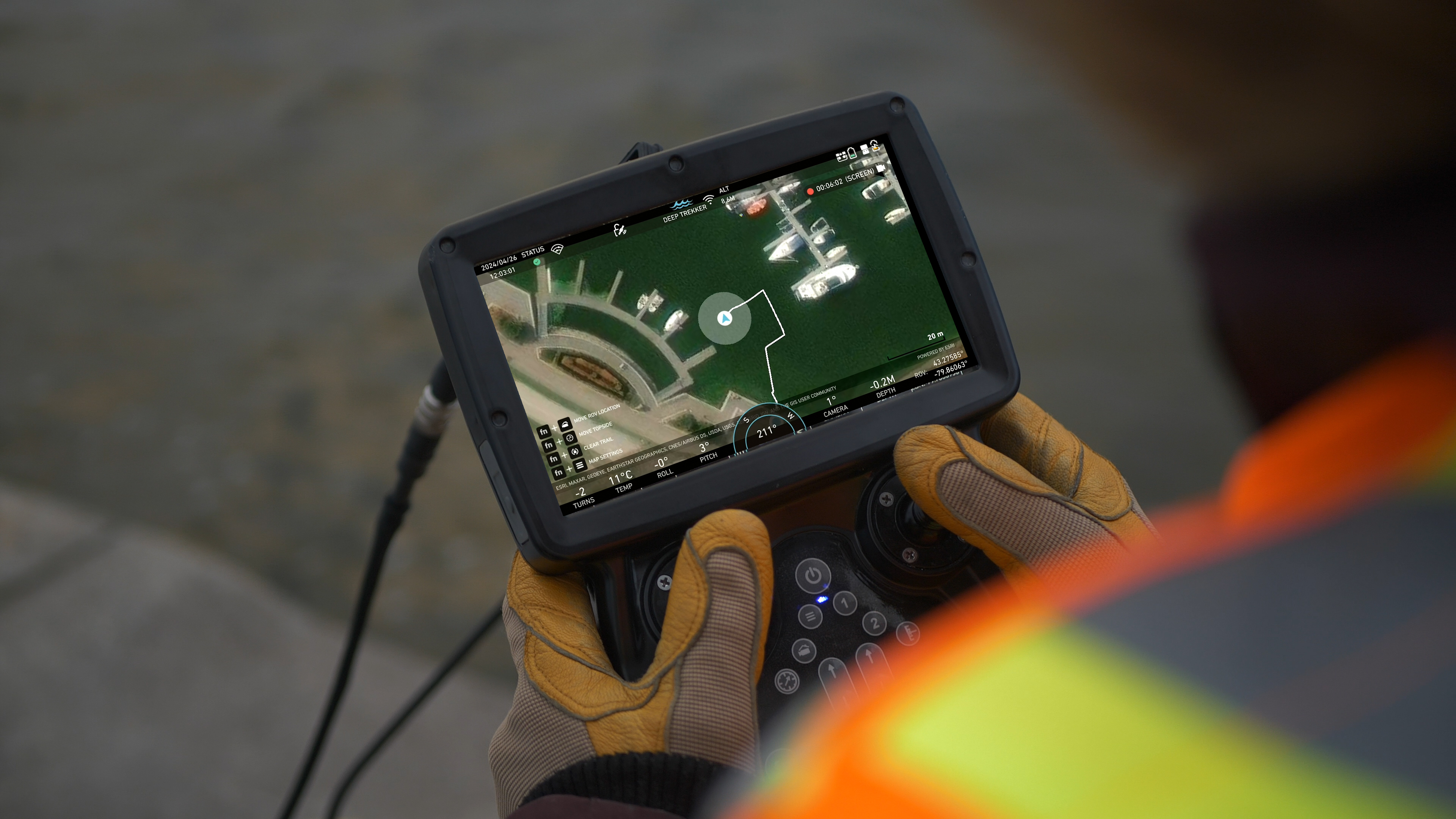
A key capability enabled through this architecture is Dead Reckoning: estimating vehicle position from onboard sensor data when GPS is unavailable, and external references are limited. Within this navigation stack, Xsens MTi-3 provides AHRS-based inertial motion and orientation data used to support odometry estimation and Dead Reckoning.
This enables practical field workflows such as:
- Visualizing the ROV’s movement on a map
- Creating breadcrumb trails during search or inspection missions
- Marking waypoints and points of interest
- Supporting mission planning and route-following workflows
- Improving repeatability for survey and inspection tasks
“The Xsens sensor has enabled our Dead Reckoning technology, which allows users to navigate underwater and have a clear understanding of where they are on the map.”
— Sabina Balean, Product Manager, Deep Trekker
Why Deep Trekker selected Xsens
Deep Trekker selected Xsens about three years ago after evaluating alternative motion sensing options. The decision was driven by a practical combination of mechanical fit, sensor performance, integration support, and commercial suitability.
Key engineering selection factors included:
- Form factor: Compact enough to integrate into Deep Trekker’s ROV architecture
- Motion performance: Suitable for the Dead Reckoning and odometry requirements of the navigation system
- Angular random walk and in-run bias stability: Important parameters for maintaining useful motion estimates over time
- Price-performance balance: A fit for scalable product integration
- Developer experience: Development kits and C SDK helped the engineering team validate quickly and reduce integration friction
- Magnetic-environment performance: Recent developments in magnetic interference rejection using Xsens Avior help support higher accuracy in environments such as ship hulls and tanks
For Deep Trekker, Xsens MTi was not simply a component choice. It provided the IMU/AHRS input needed to support odometry estimation inside a compact underwater navigation system.
Integration and field considerations
The Deep Trekker team was impressed with the ease of implementing the Xsens sensors into vehicles, highlighting that the development kits and SDK made it possible to get up and running quickly for validation. They also note that the mechanical form factor of the Xsens products made integration into their system easier.
The integration can be understood across three layers:
- Hardware integration: SensorPod+ houses the navigation-related sensing used to support Dead Reckoning in Deep Trekker’s ROV platforms.
- Calibration and field operation: Magnetic calibration is a known challenge underwater, especially near ship hulls, tanks, and other ferrous structures where heading can be affected.
- Software workflows: In BRIDGE, the navigation data is translated into operator-facing tools such as map-based movement, breadcrumb trails, waypoints, points of interest, and mission planning.
Deep Trekker also notes: "We've also been impressed by recent developments in magnetic interference rejection using the Xsens Avior sensor which has unlocked even higher accuracy in motion sensing in magnetic environments such as ship hulls and tanks."
This layered integration helped Deep Trekker turn inertial sensor data into practical navigation features that operators can use directly in the field.
Impact: concrete outcomes for ROV operators
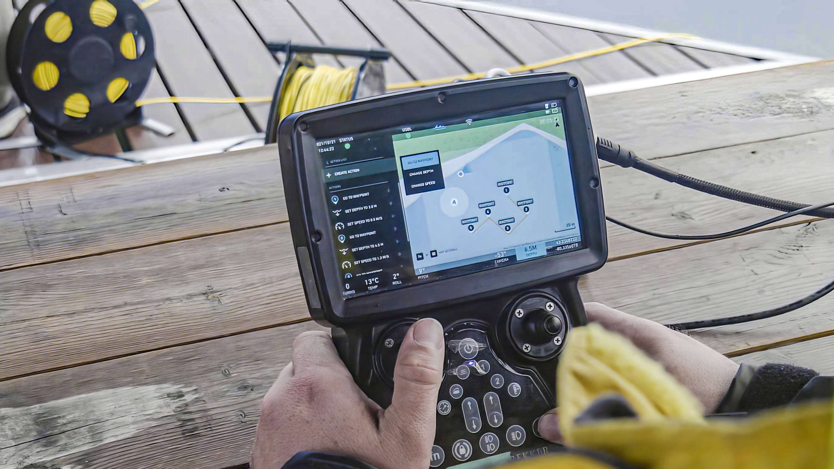
With Xsens MTi-3 and Xsens Avior integrated into its ROV navigation stack, Deep Trekker translates inertial sensing into practical workflows for search, survey, and inspection missions.
For Search & Recovery, breadcrumb trails help operators see which areas have already been covered, improving coverage awareness during time-sensitive missions.
For survey operations, route-following and waypoint workflows support more repeatable transects, helping operators collect more consistent underwater data.
For inspection teams, map-based movement and points of interest provide clearer context around underwater assets, especially when visibility is limited or when the ROV operates around complex structures.
These capabilities also create business value. Deep Trekker customers can save on survey costs, reduce downtime, and lower risk to personnel by completing more underwater work with ROVs.
As underwater operations move toward photogrammetry, SLAM-style mapping, and digital twin workflows, accurate motion and localization data are becoming increasingly important. Small errors in motion tracking can affect model quality, making reliable inertial navigation a key part of future underwater inspection and mapping system.
Conclusion
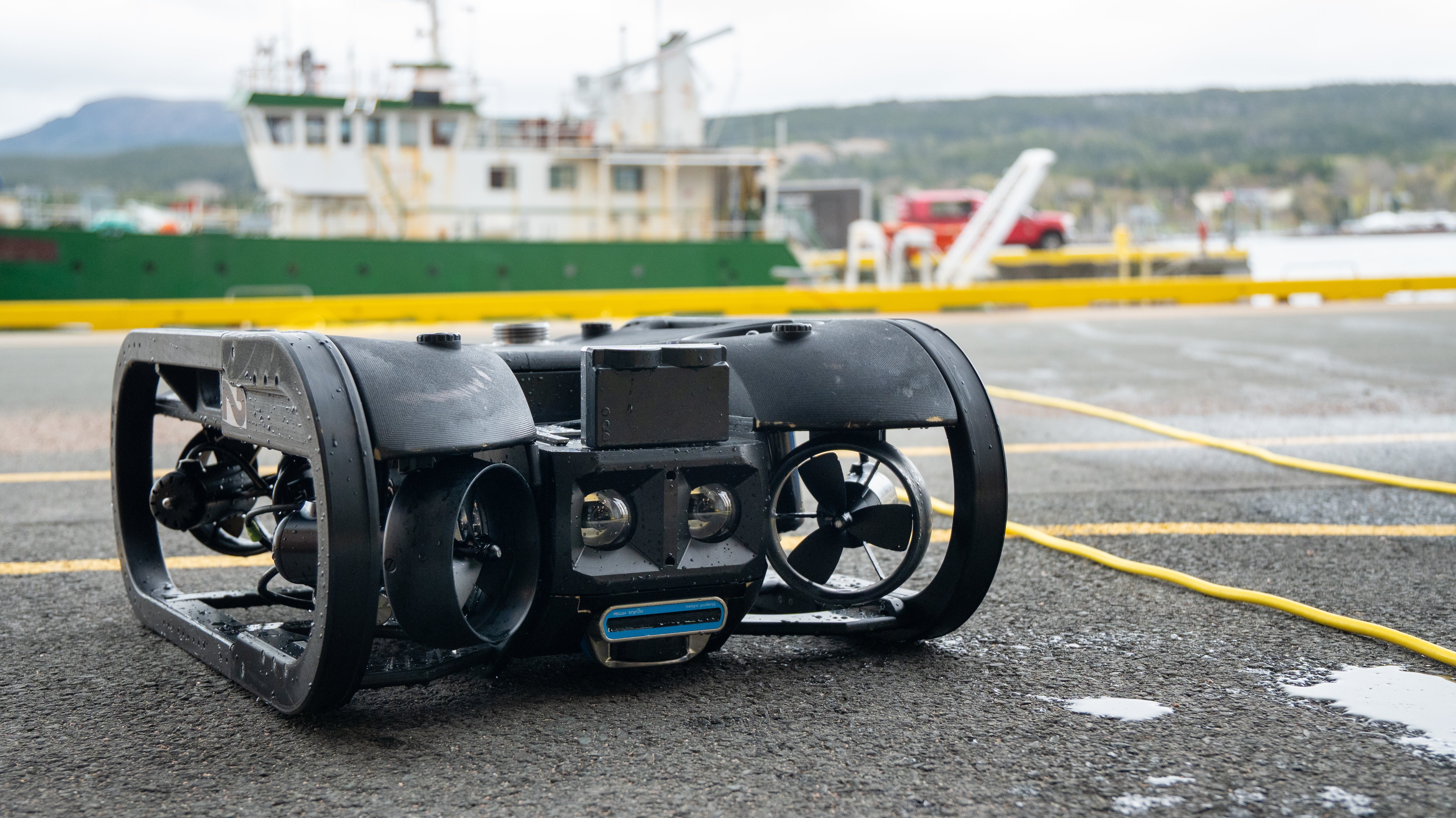
By integrating Xsens MTi-3 into SensorPod+ and Avior into its ROV navigation stack, Deep Trekker strengthened the Dead Reckoning capabilities behind its ROV navigation workflows. For engineering teams, the case highlights the value of compact inertial sensing, reliable AHRS performance, SDK support, magnetic-environment robustness, and field-ready integration. For operators, the result is more usable navigation context during search, survey, and inspection missions.
A special thanks to Deep Trekker for sharing their insights and supporting the development of this customer case.
FAQ
How do ROVs navigate without GPS?
ROVs navigate without GPS by using onboard sensors and external references to estimate position and movement underwater. In a Dead Reckoning workflow, sensors such as IMUs, AHRS modules, DVLs, depth sensors, and other navigation inputs help estimate how the vehicle moves over time. Deep Trekker uses SensorPod+ with Xsens inertial sensing, DVL, and BRIDGE software to support underwater Dead Reckoning workflows.
What is Dead Reckoning in underwater navigation?
Dead Reckoning is a navigation method that estimates a vehicle's current position based on previous position, movement, direction, and velocity. Underwater, this is important because GPS does not work below the surface. For ROV operators, Dead Reckoning can support map-based movement, breadcrumb trails, waypoint workflows, and repeatable search or survey patterns.
Why is an IMU or AHRS useful for ROV navigation?
An IMU or AHRS provides inertial motion and orientation data such as acceleration, angular rate, roll, pitch, and heading. In underwater ROV systems, this data can support odometry estimation, heading awareness, and Dead Reckoning when GPS is unavailable. For engineers, performance parameters such as angular random walk, bias stability, size, integration support, and magnetic behavior are important when selecting an inertial sensor.
Why did Deep Trekker choose Xsens?
Deep Trekker selected Xsens after evaluating alternative options. The team highlighted form factor, motion performance, price-performance balance, and SDK support as key factors. The development kits and SDK helped the engineering team validate quickly, while the mechanical form factor made integration into the system easier.
What role does magnetic interference play in underwater ROV navigation?
Magnetic interference can affect heading reliability, especially near ship hulls, tanks, subsea structures, and other ferrous environments. For underwater systems, reliable inertial sensing and careful calibration are important to maintain useful navigation data in real-world field conditions. Deep Trekker also highlighted recent developments in magnetic interference rejection using Xsens Avior.