29th September 2017
Industry, aeronautics, and marine vehicles all rely heavily on 3D motion tracking sensors to provide accurate heading and attitude reference information. The Attitude Heading Reference Systems (AHRS) typically used in these applications employ gyroscopes, accelerometers, and magnetometers to sense 3D orientation. While pitch and roll orientation can be determined by the ever-stable properties of gravity, yaw information generally depends on the earth’s magnetic field to provide heading reference data—and that presents a problem.
The challenge you may encounter in your 3D motion tracking applications is how to maintain accurate heading information, despite localized distortions in the earth’s magnetic field. The presence of magnetically-permeable materials, strong electrical currents, or both, within the platform’s environment, can produce significant errors in magnetometer data by distorting the magnetic field upon which they rely for reference.
Xsens Motion Tracker products for industrial applications include proprietary software algorithms and customizable Kalman filters that reduce directional errors to acceptable levels. We have an extensive whitepaper available as a free download.
The MTi product line allows you to programmatically customize the way your MT mitigates the particular magnetic disturbance encountered by your platform. By choosing one (or a combination) of the following techniques, a satisfactory solution can be found to correct most direction errors.
- ZeroRotationUpdate (ZRU)
- Active Heading Stabilization (AHS)
- Magnetic Field Mapping (MFM)
- In-Run Compass Calibration (ICC)
- Global Positioning System (GPS) /Global Navigation Satellite System (GNSS)
- Heading Estimation Using GPS Acceleration
Here are six applications commonly affected by magnetic disturbances, and which can benefit from the six solutions just described.
1. Applications Where Sensors Are Periodically at Rest
Some platforms are periodically at rest during normal use. Using Zero Rotation Update (ZRU), the MT uses periods of inactivity to measure gyroscope bias and to adjust heading data output accordingly.
Since ZRU updates only when devices are at rest, this solution is best suited for applications where the platform has periods of brief movement followed by periods of inactivity.
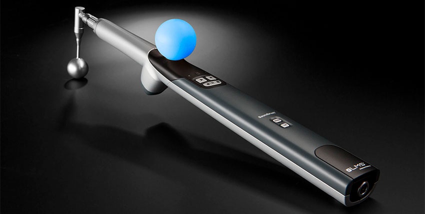
One such application is the LMS SoundBrush. Using the MTi-200, the SoundBrush enables 3D mapping of sound fields, showing the direction and intensity of sound waves emitted by a device.
2. Robotics
One solution that is exclusive to the MTi product line is Active Heading Stabilization (AHS). AHS also compensates for gyroscope bias when the device is at rest, but with a 20-fold improvement in accuracy compared with gyroscope dead reckoning.
AHS is often the ideal solution when high-precision heading information is required, even when magnetometers cannot be used. Indoor robotics is one such application.
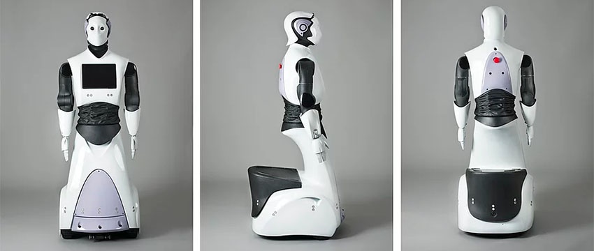
PAL Robotics, for example, uses the MTi-30 AHRS module to sense the attitude of its humanoid robot. AHRS is a cornerstone in the REEM-C walking robot, and provides feedback for all of the algorithms that keep the robot balanced.
3. Remotely-Operated Vehicles and marine vehicles
Heading errors that occur with outdoor applications, such as ROVs and marine vehicles, can often be resolved using Magnetic Field Mapping (MFM). By creating a 3D map of the magnetic field surrounding the platform, MTi products can nullify magnetic disturbances created by the platform itself. BluePrint Subsea incorporates the MTi-3 AHRS module into its X150 USBL tracking beacon to provide a highly accurate 3D attitude reference.

4. Applications Without a Host PC
Another route error solution available only from Xsens is In-Run Compass Calibration (ICC). ICC corrects for magnetic disturbances caused by objects that move with the platform. Since ICC uses an onboard algorithm, it is ideal for applications where connection to a host PC is not possible, such as autonomous drones. Autonomous Control Systems Laboratory Ltd. (ACSL) employs the MTi-30 module to provide fast and accurate 3D orientation data for its MS-06LA MINISURVEYOR autonomous aerial drone.
The embedded processing power offered by ICC allows the MINISURVEYOR to perform infrastructure inspections—even in high-radiation environments, disaster assessments, crop spraying, and aerial photography.

5. Automotive and Outdoor Applications
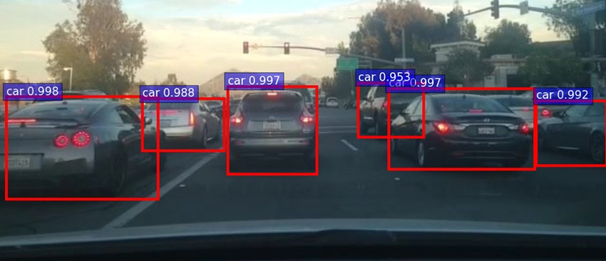
Automotive and aeronautical applications often need a high-performance GPS/GNSS receiver. The MTi-G-710 module not only offers outstanding GPS/GNSS capability, but is a full-featured AHRS, complete with 3D sensors for acceleration, rate of turn, and magnetic field sensing. The multiple-constellation configuration of the MTi-G-710 provides superior heading accuracy, even with limited GNSS visibility. GPS/GNSS is proving its value in the emerging autonomous car industry.
When Vector.ai, a developer of robotics artificial intelligence technology, needed a high-performance solution, it found a solution in the MTi-G-710. Using the MTi-G-710, the tech startup is able to capture the GPS/GNSS and AHRS data it needs to develop its Deep Neural Network. Although Vector.ai is currently involved in prototyping autonomous car technology, the MTi-G-710 meets the tight requirements for OEM applications in self-driving cars.
6. Small Aircraft and Ships
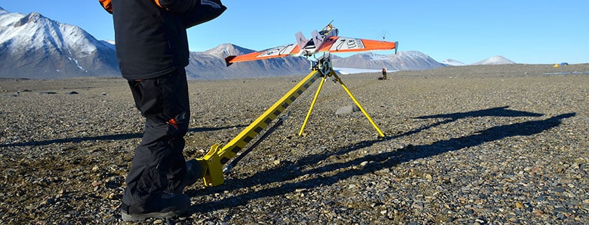
Aircraft and maritime vehicles can experience bearing errors caused by tailwinds and water currents that cause estimated directions to differ from true headings. Heading Estimation Using GPS Acceleration compares GNSS acceleration with accelerometer readings to produce a highly-accurate heading, regardless of the degree of drift. Aeroprobe, a leader in air data and flow measurements systems for automotive, wind turbine, and aerospace industries, has developed the Micro Air Data System (µADS) UAV to facilitate atmospheric studies. Key to the µADS providing the accurate data needed for atmospheric research is its ability to first maintain accurate data on the orientation and speed of the UAV. By integrating the Xsens MTi-G-710 GPS-aided Inertial Navigation System (INS), the µADS can accurately determine air flow velocity and angles, attitude, position, UAV velocity, and acceleration.
The flexibility of the INS module enables Aeroprobe to offer its aerial Micro Air Data System with customized configurations, depending on customer requirements.
Finding Your Solution
Regardless of how much time and money you have invested in R&D, directional errors can take your project off course, and delay your product’s introduction to market. But identifying the cause of these errors is only half the battle. Knowing how to correct them is another story.
The Xsens MTi family of 3D orientation sensors provides proven technology to correct the most common heading errors caused by magnetic field disturbances. Whether your challenge lies in aeronautical, maritime, industrial, or automotive applications, software-based motion tracking offers a solution.
Download the free Whitepaper
Xsens has a free whitepaper available that explains the MTi System Architecture: "The Next Generation Xsens Motion Trackers for Industrial Applications".
It reveals in great detail what happens inside the orange box.
So in short it explains more on the:
- System Architecture
- Applications
- Engine
- Portfolio

Related articles